Machu Picchu is the iconic travel destination, Bolivia is the hidden gem, and Lake Titicaca straddles them both!
Cusco is the requisite stop on the way to Machu Picchu, and it was a fantastic city. The food, especially the ceviche, was incredible.
Food pix never do the meal justice, but trust me, it was tasty! After exploring Cusco, we caught a train through the Andes and made it to Agua Calientes, a hive of travelers placed below Machu Picchu.
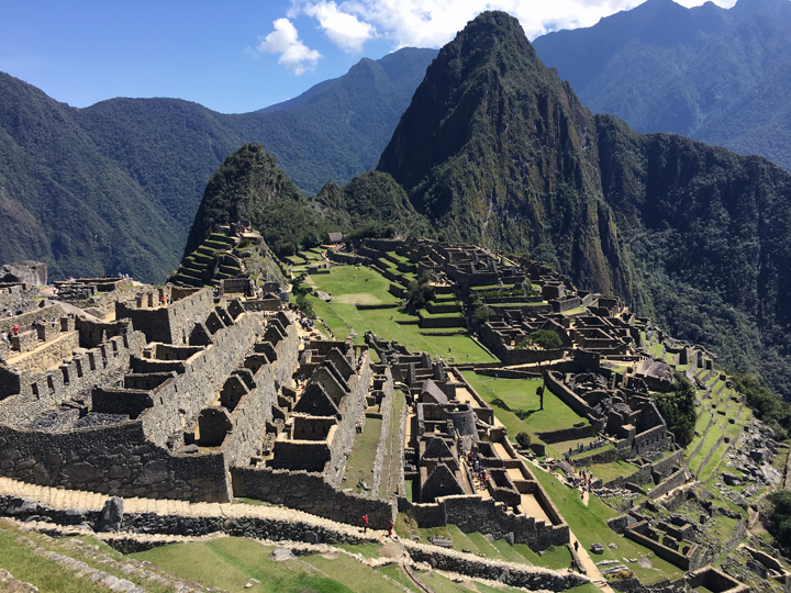
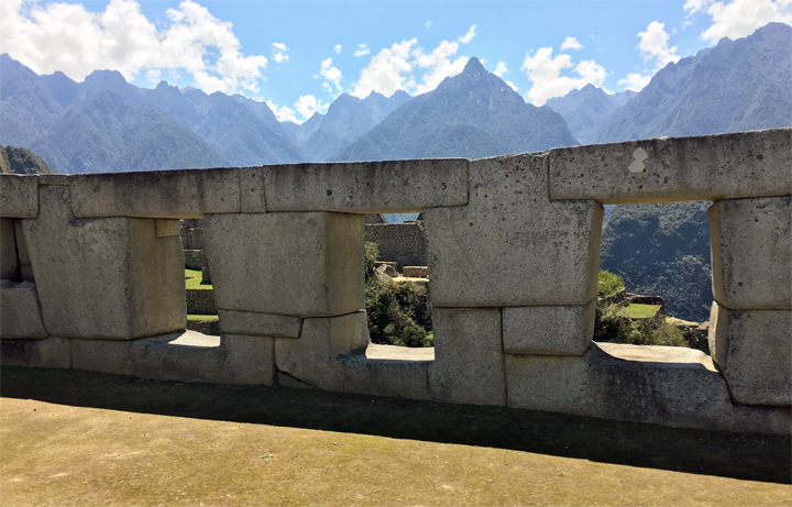
And then… Machu Picchu. The internet is rife with Machu Picchu pictures, but it’s worth adding a few more. With an elevation of almost 8,000 feet and enough water, land, and rock to sustain a small city, it’s truly a wonder of the world.
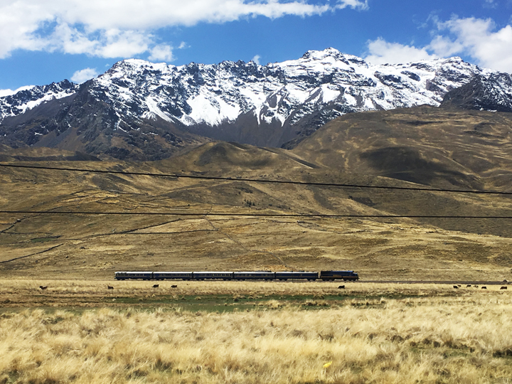
After a day of taking in the sights, we hit the dusty road back to Cusco. We met many people fresh off the Machu Picchu Trail, ended their trek at Machu Picchu. If I had time, I would love to have done that, but alas I did not. The next day we hitched a bus ride across the high planes of Peru, via Abra la Raya at 14,222 feet, to Puno on the Peru/Bolivia border.
Abra la Raya at 14,222 feet
Beautiful Andes Mountains.
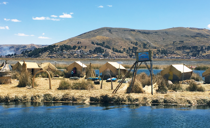
The border city of Puno is right on Lake Ti-ti-ca-ca! The highest navigable lake in the world at 12,507 feet. We’ve heard of the floating islands growing up, and we finally got to see them.
The islands are reeds bound together, floating on top of the water, and anchored to the lake floor by ropes. Unfortunately, the island culture is now dominated by tourists taking pictures of the islands, so the sight was bitter-sweet. But after Lake Titicaca, Bolivia!
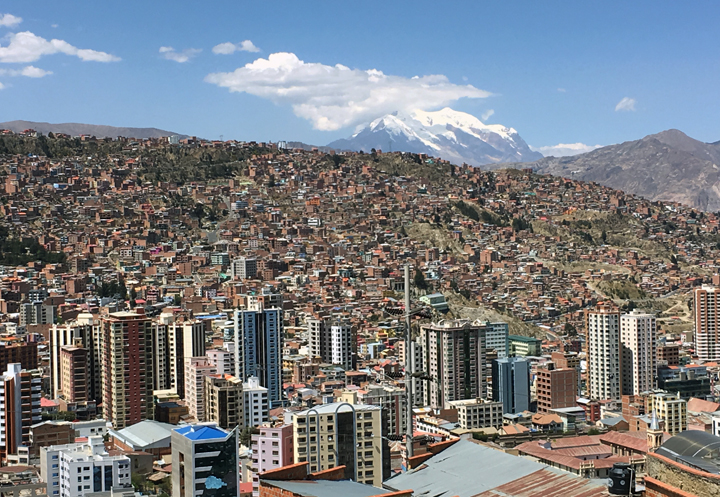
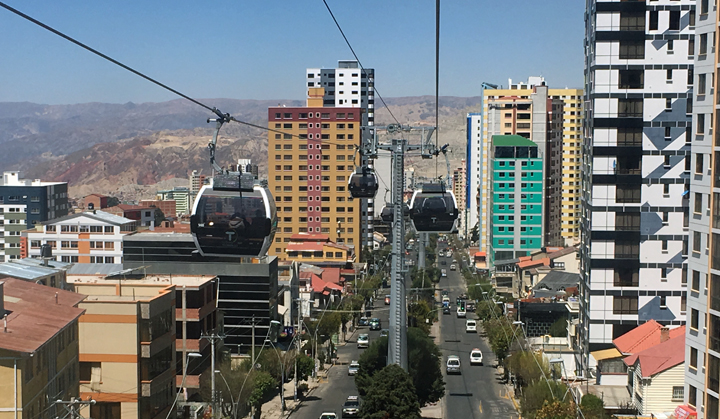
La Paz is a sprawling city located in the Andes of about 2.3 million people resting at 12,000 feet. The city recently installed cable cars the navigate the city instead of bus or taxi, they were amazing!
La Paz
Cable Cars down a main street
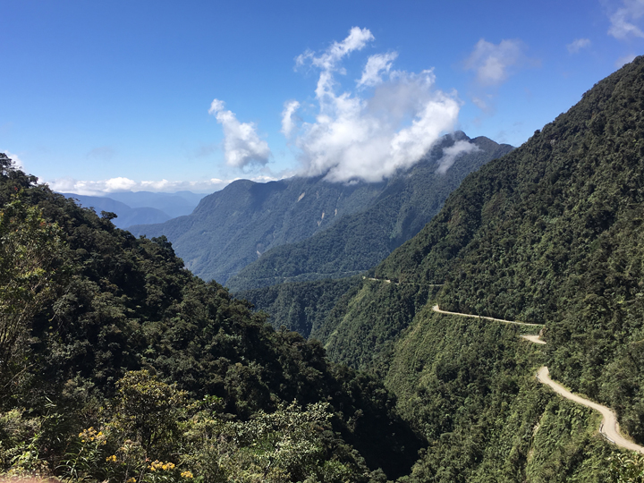
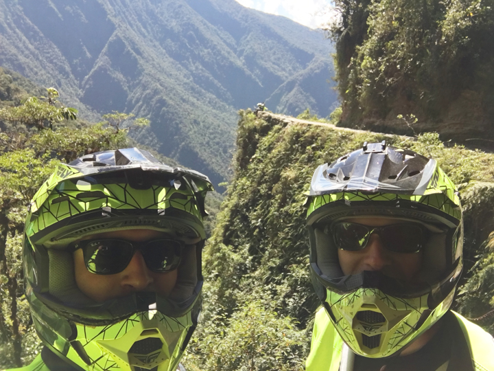
Outside of Lap Paz is the famous Death Road. This used to be a main thoroughfare outside of La Paz until a modern highway system was built. When it rained, cars passing each other would fall off the cliffs and fall hundreds of feet. Now that a paved highway system exists, Death Road is used for the occasional car and now for bikers looking to conquer it!
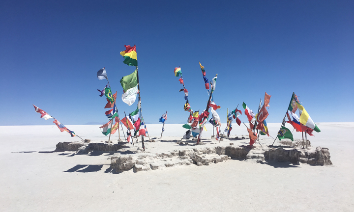
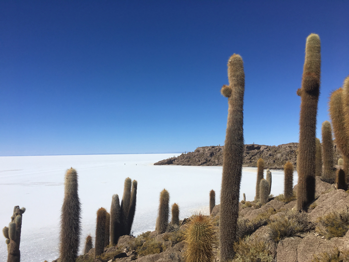
Our last stop in Bolivia were the Uyuni Salt Flats, and truly the hidden gem of the trip! There’s supposedly enough salt to feed humanity for 5000 years. The locals scrape some of the salt from the flats and sell at market. It’s also a place to take incredible photos!
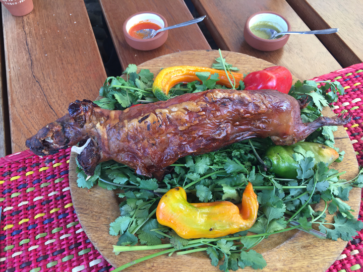
As the trip winded down, we headed back to Peru and there was one last check in the box, a Guinea pig lunch! It was kind of weird…
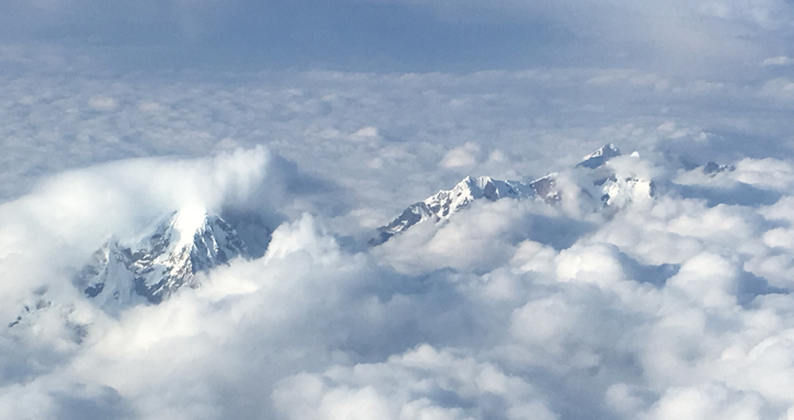
All good things come to an end, but on the flight home I caught one last look at the Andes. Adios Peru y Bolivia!
Truly an adventure. 8 days up. 3 days down. Kathmandu > Lukla > Phakding > Namche Bazar > Deboche > Dingboche > Loboche > Gorak Shep > EBC > Kala Patthar > Pangboche > Namche Bazar > Lukla > Kathmandu!
Things to remember for next time:
Take the Diamox/Acetazolamide (altitude sickness medication) starting at Namche Bazar
Bring plenty of toilet paper ($5/roll at the top)
Bring hot sauce for food (menu is the same at every place)
Kathmandu
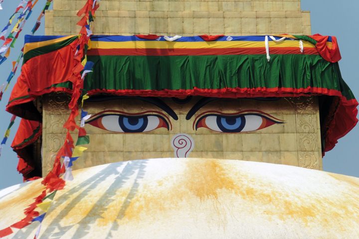
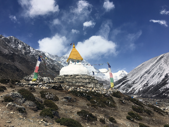
If you’ve been to a dusty, noisy, congested Southeast Asian city, you’ve been to Kathmandu. There are heaps of prayer flags, sacred Hindu sights, and the great Buddha eyes, those eyes…
Buddha Eyes
The best reason to go to Kathmandu is to get to the trekking region! Shall we?
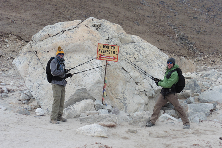
Day 1 – Kathmandu to Lukla to Phakding
Flying from Kathmandu to Lukla is a trip in itself. It was… a little scary. The runway is sloped uphill to slow the planes while landing, and it helps them speed up on takeoff.
When I got out of the plane, I immediately noticed the sky-scraping mountains.
View from Lukla
From Lukla (9,383′) we hiked to Phakding (8,562′). I’ll track the elevation because it will quickly become more impressive! The hike to Phakding was along a river, in a valley, across suspension bridges, and adorned with prayer flags.
Trekking to Phakding
I immediately noticed the incredible height of the mountains above me. In my past hiking experiences in Colorado, the peaks were never that much taller than you. You start maybe at 8,000′ or 10,000′ and hike to 13,000′ or 14,000′. In the Everest region, peaks you can see are miles above your head. At my highest point, 18.037′, I could see the top of Everest, but it was still 11,000′ above my head!
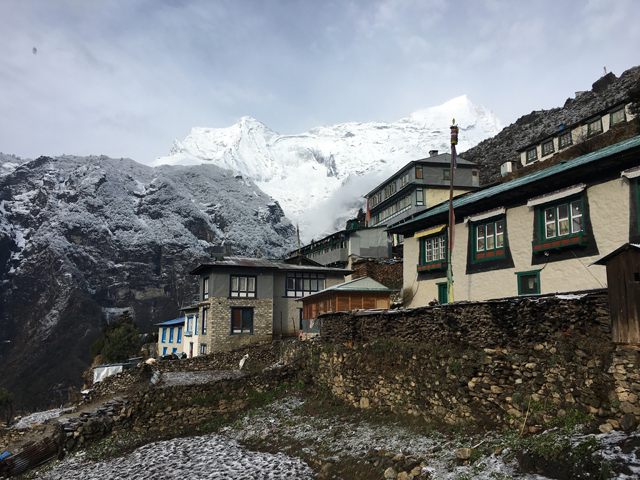
Day 2 – Phakding to Namche Bazar
The first day I thought, this isn’t that hard. Well, we actually LOST elevation the first day. Day 2 was the first “real” hiking day. Phakding, 8,562′, to Namche Bazar, 11,286′. It was a little more difficult, but again, nothing crazy.
Trekking to Namche Bazar
The last part of the hike was over the top suspension bridge in the background of the above picture. The hike brought us to the last big city int he Everest region, Namche Bazar, ATM included!
Above Namche Bazar
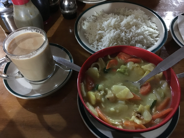
We were eating some tasty food, below is a bowl of sherpa stew with milk tea and rice. The other staple was Dal Bhat, kind of a vegetable curry. We aggressively ate them in the beginning, but 7 days later… it because very, very, very repetitive (hence the hot sauce recommendation).
Sherpa Stew
Day 3 – Acclimatization Day in Namche Bazar
First views of Everest!
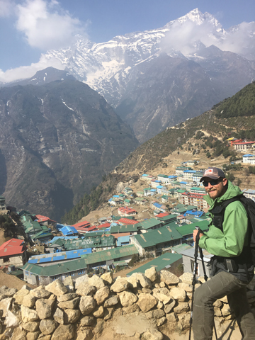
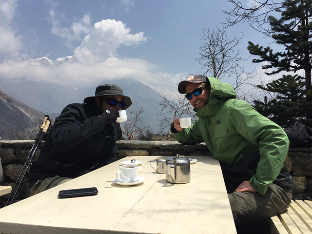
On the acclimatization day, we hiked from Namche Bazar to the Everest View Hotel for our first view of Everest and a cup of coffee.
After our cup of coffee we hiked back down to Namche Bazar, relaxed, explored the curio shops, and prepared for the next day.
Day 4 – Namche Bazar to Deboche
Snow awaited us when we woke up! Then off to Deboche (12,168′).
Namche Bazar
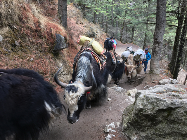
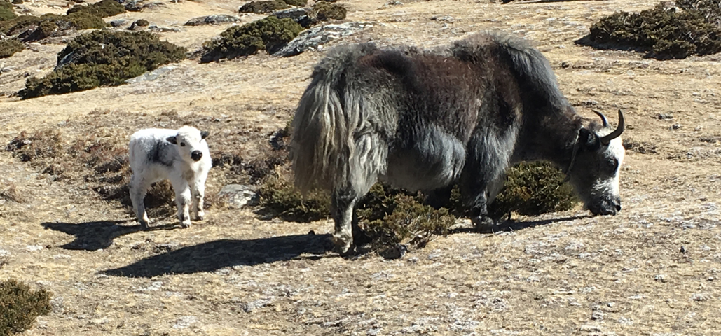
There were many Yak-if (Yak traffic) jams on the trails. You just had to wait it out! And also stand up the mountain from the the yaks because you wouldn’t want them pushing you off the trail, tumbling down the mountain, as they passed.
Yaks
Day 5 – Deboche to Dingboche
A beautiful hiking day! Also the highest elevation I’d been in my life and the first day of altitude sickness… We hiked from Deboche (12,168′) to Dingboche (14,469′).
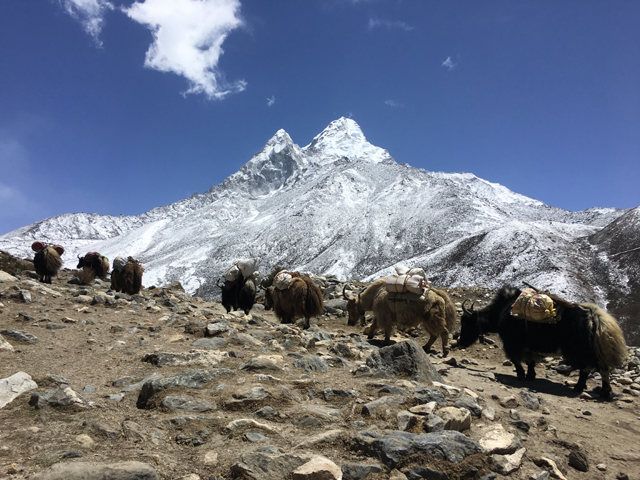
A view of Ama Dablam
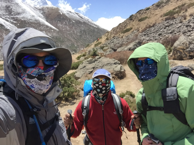
Keeping out the dust
Arrival at Dingboche
The tallest peak in the continental United States is Mt. Whitney, 14,505′. I’ve hiked above 13,000′ with no problems. But hiking at altitude and sleeping at altitude depletes your body and by hiking to 14,469′, I began to encounter headaches, mild dizziness, and shortness of breath at night. Not fun! Despite these issues, we chose only to take the altitude medication “in case we really needed it.”
Day 6 – Acclimatization Day at Dingboche
In the morning, we did a short hike about a 1,000′ higher than where we stayed. The views were spectacular as usual.
Day Hike View from Dingboche
When we got back from the hike, we were generally feeling terrible with headaches and sleepiness. But it seemed like everyone around us was having the time of their lives! It didn’t make sense, was everyone else in better shape than us? Trained harder? Something else? We asked around, “are you on Diamox?” The overwhelming answer was, YES! We figured that was why everyone else looked happier than us, so we popped the pills.
Day 7 – Dingboche to Loboche
The next few days kept breaking my personal record for highest altitude ascended. We were off to Loboche (16,104′)!
Baby Yak!
Just another great view
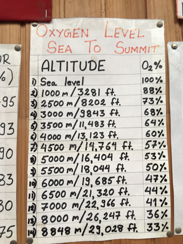
Altitude…
The above picture is one of my favorite. It was at our “hotel” in Loboche. According to the chart, we were around 55% oxygen compared to sea level. I can’t say we were feeling great, but the effects of altitude seemed to be stuck at just mild headaches. Was the Diamox helping? I assume so. We did see someone collapse on the side of the trail and there was an almost endless flow of helicopter traffic from the mountain trails back to Lukla, so at least we weren’t that bad!
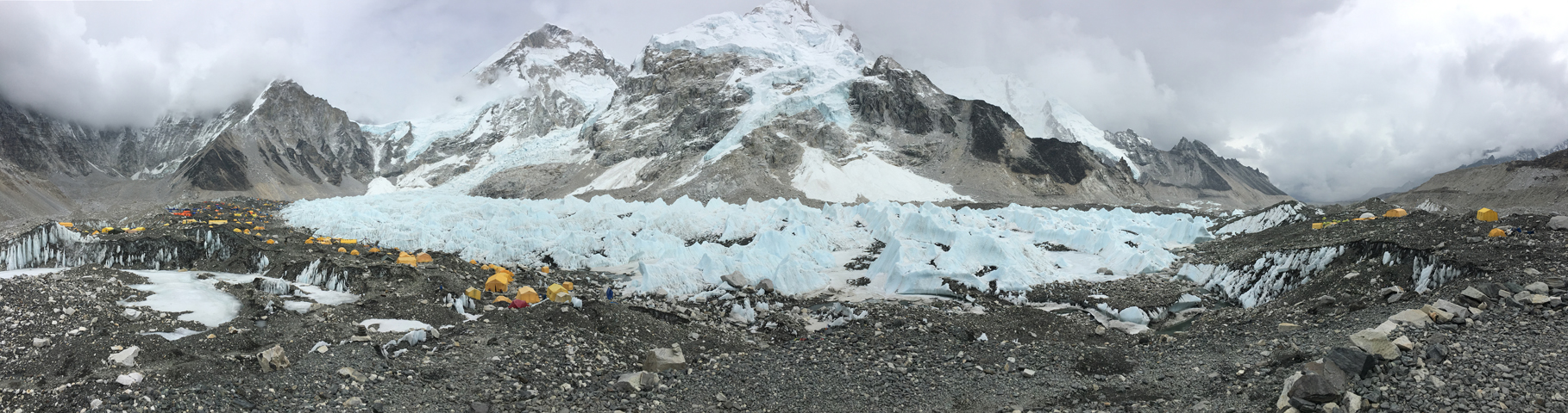
Day 8 – Loboche to Gorak Shep to EBC!
The morning was spent hiking to Gorak Shep (16,859′), we had lunch (more Dal Bat – real tired of it at this point), and then to EBC (17,846′)!
We kept wondering, where is Everest? Where is Everest? Well, you actually can’t see Everest that much on this trek, we did catch a glimpse on the way to EBC, but it was generally cloudy that day and didn’t get a good view.
Almost there!
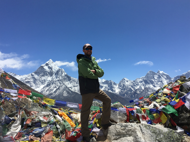
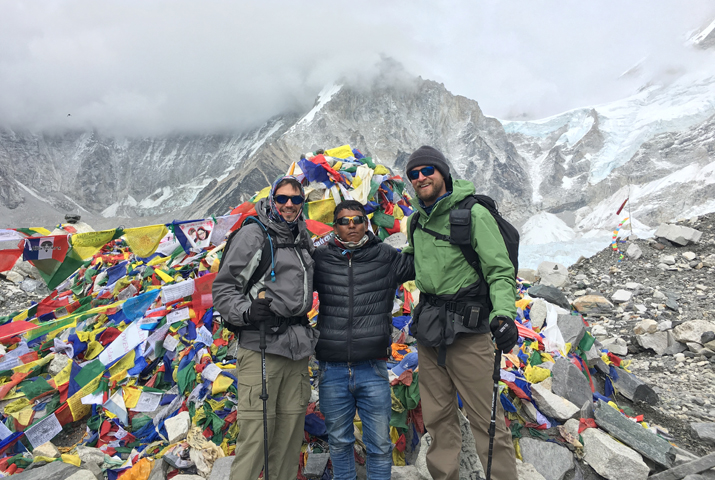
EBC “summit” with our guide!
EBC
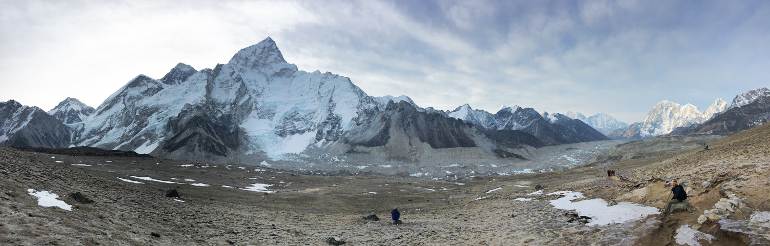
Day 9 – EBC to Kala Patthar to Pangboche
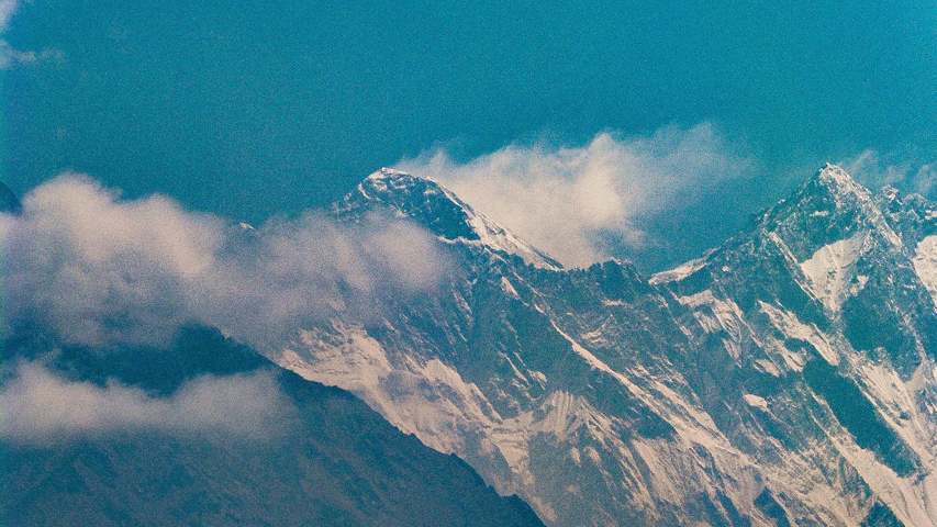
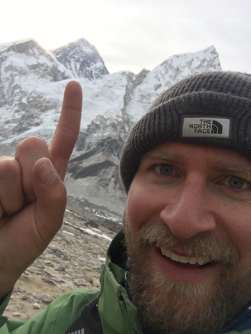
The hardest day by far. We woke up at 5a.m. to hike to the highest point of our trip, Kala Patthar (18.037′), and the best views of Everest!
Everest is the black triangular peak to the left of the highest peak in the picture
Everest is directly above my finger
Once we reached Kala Patthar, we hiked back to Gorak Shep for breakfast, and then hiked a looooooooong 10 miles down to Pangboche (13,074′). Exhausting!
Day 10 – Pangboche to Namche Bazar
At this point, we were just on the dusty road home, hoping that the water for the shower was hot in Namche Bazar (it had been a while).
Trekking back to Namche Bazar
Day 11 – Namche Bazar to Lukla
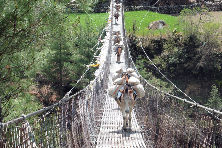
What took us 8 days to get up, only took us 3 days to get down. Our pace was fast, only hindered by the occasional donkey in the way.
Day 12 – Lukla to Kathmandu
Everyone we met, our guide, our porter, the other trekkers were incredibly nice, everyone was there for the same reason – to enjoy this beautiful earth! EBC trek was not a vacation, it was an incredible adventure!
Why are you going to Russia, they asked? Don’t you know you’re going to be followed, captured, or worse? Also, don’t take pictures of buildings or you will be arrested. You’ll have to pay off the police. Your phones will be hacked. Do you know anyone there? Why go? What’s there? Well… that’s what I wanted to find out!
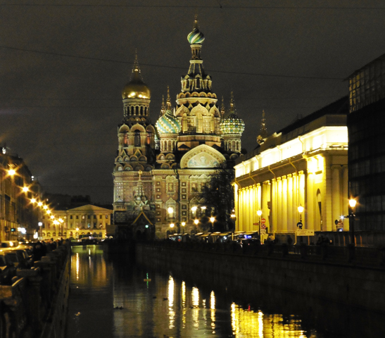
First stop, St. Petersburg. The architecture was a beautiful mix of old eastern Europe and Soviet grandeur.
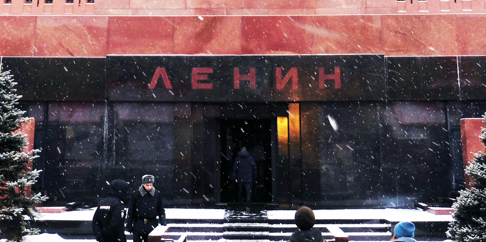
Second stop, Moscow. A lesson in Soviet History and present day Russia. Below is the tomb of Vladimir Lenin. The text is the Russian cyrillic characters. Those were fun to learn and read.
The Russian people I met were very nice. Also curious that a young American was actually visiting Russia for something other than business. Moscow has a similar feel to New York City. The food was familiar and fantastic. People complain about how cold it is. There are Starbucks, McDonalds, and even a Krispy Kreme! In short, it didn’t seem that different than American life. At least day-to-day. However, their leaders are not as tolerant. Our countries are at odds in Syria. The U.S. intel community is certain Russia hacked into American politics. And we happen to be the two nations in control of virtually all the nuclear warheads in the world. Things could be better.
Coincidentally, when I returned to the U.S., I read a National Geographic Article about why the young generation was pro-Putin. I would say the generalized American perception of Putin is that he is evil, oppressive, and the Russian people want him out of power. However, the NatGeo article describes how he is generally liked in Russia. A brief history of Russia since is Soviet days: the 90s were terrible, Putin assumed power in 2000, and since then people have more money, unemployment is down, and some of Russia’s “prestige” has been restored. Whether or not that was solely Putin’s doing is debatable.
What am I getting at? It seemed far from the “bad” place that everyone described to me before going. I never felt in danger. No one followed me (that I know of). I took hundreds of pictures of many things with no consequence. No bribes. No phones hacked (that I know of).
I’m no historian, but the following is what I surmised about the rise of the Nazi party in Germany from spending time at the Dachau concentration camp outside Munich and the Documentation Center a.k.a. Nazi Rally Grounds in Nuremberg.
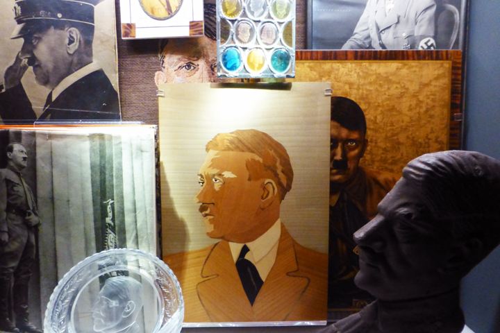
Hitler Propaganda
Pre-WWII, the German people were generally depressed for starting and losing World War I. Hitler struck a nationalist nerve in the people and rallied them to make the German Vaterland, Fatherland, great again. Hitler’s rise to power was not quick. He joined the Nazi party in 1919. He was convicted of treason in 1923 and went to jail for a failed Coup to forcefully seize power in Munich. In jail he wrote Mein Kampf and after he got out he gained popularity by being anti-Treaty of Versailles/Jew/Communist. He didn’t like sharing power, so he killed members of the Nazi party to solidify his control over the party and the SA, Sturmabteilung, the brown shirted goons with red Nazi armbands that went around harassing people that the Nazis didn’t like. During a country-wide parliamentary election, the Nazi party won the majority in government and Hitler was named Chancellor of the Weimar Republic (what Germany was called at the time). Paul von Hindenburg was the President and Hitler was the Chancellor. Through pressure by powerful people, a general weakness by the President, and a hope by Paul von Hindenburg to placate Hitler’s crazy ideas, the presidency was dissolved and Hitler was named Supreme Chancellor with full control of government in 1933. Enter the Third Reich. The rest is history.
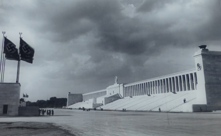
Nuremberg Rally Grounds
It was amazing to me that any of this really happened. I can’t imagine an age without instant communication and 24 hour news coverage. I don’t think Hitler would have been able to seize power through murder, coercion, and general disregard for the law in this day and age. It seems like all of the above happened (the shady stuff at least) with most of the people in the dark. Then one day Hitler announced he was Supreme Chancellor and with his powerful SA, no one could really stop him. Obviously, there were many pro-Hitler supporters that wanted to make Germany great again, but I doubt (hope at least) people knew about or accepted Hitler murdering people to get his way or the quick dissolution of the Weimar Republic government to pave the way for a Hitler-run totalitarian regime.
My brother and I eagerly await our 7:30 a.m. ride to the safari company HQ for our two-day camping trip in Chobe National Park, Botswana. This morning’s destination is a car trip, a boarder, a river crossing, and another boarder away.
7:40 a.m., concern sets in that our driver is not coming.
We were told by the safari company that someone would pick us up. I inquire at the front desk of our hostel. The hostel woman doesn’t know anything about our pickup, she says, “We do business with dem all da time, but I cannot call dem. It’s international.” My iPhone with pre-paid Skype credit finally pays off! On the phone, the safari company tells me they arranged for our hostel to take us to the boarder, and they would pick us up from there. Our hostel has never heard of this arrangement. DAMMIT! OK. Doesn’t matter. Moving on. How do we get there now? Taxi? Shuttle? If we’re late, we’re going to miss the pickup for the safari. The hostel arranges for a taxi. The best driver they know. He will drop us off at the boarder. Wait! What do we do at the boarder? How will we find the safari guy? Don’t worry, the hostel woman says. ”A man will be dare. E will meet you at da boa-da.” There’s no time, or hope, for more detailed information. Let’s go! The taxi picks us up. Two minutes into the trip, he stops for gas. COME ON! OK, now we’re off. It’s a nice 45-minute ride to the boarder, just a few swerves around potholes that could swallow our small car whole, not a big deal. The taxi drops us off at the Zambian/Botswana boarder and drives away. There are hundreds of people around. They are selling goods, exchanging money, and calling to us for a taxi. We just got out of a taxi. We don’t need a taxi, we need to find the safari guy! We look around, not really seeing anyone that looks like our guy. OK, we figure that we need to at least leave Zambia and enter the no man’s land between the Zambia and Botswana boarder. Boarder crossing, no problems, we are now in no man’s land. A river separates the two countries, and we need to get to the other side. Well, we think. Sometimes when traveling you try to “blend in”, well, how can two tall white guys really blend in in Africa, more like, try to pretend like you know what you’re doing. And, sometimes, you intentionally look like you have no idea what’s going on to attract attention. We choose the latter, hoping to attract our guy. We walk toward the approaching ferry, shuttling trucks, cars, and people between the countries, still not knowing if our guy was on the Zambia, or Botswana, side of the river. Our “not knowing what we were doing” look pays off, and many men approach us asking if we need help, if we need to exchange money, or if we want to buy the artisanal trinkets made in their home villages. We dismiss about fourteen men and the fifteenth one mumbles something. He unzips his black jacket to reveal his shirt with the safari company’s logo on it. Yes! OK, anxiety, and fear subsiding. Looks like we’re in someone’s hands now. He leads us to a small motorboat down the shore, away from the ferry, and shuttles us across to the Botswana side of the river. We meet another man who immediately asks us, “Why are you late?” Because you didn’t pick us up! Of course, we don’t say that, we say something… It doesn’t really matter, we’re hurrying towards immigration. Our newest handler walks us to the front of the Botswana immigration line (sorry!), our passports are stamped, and we’re officially in Botswana. Wait! When entering Botswana, you have to step on the chemical rug to disinfect your shoes of potential foot and mouth disease. OK, now we’re in Botswana. We climb into our handler’s jeep and we’re on our way. We make it to the safari just fine.


 After a day of taking in the sights, we hit the dusty road back to Cusco. We met many people fresh off the Machu Picchu Trail, ended their trek at Machu Picchu. If I had time, I would love to have done that, but alas I did not. The next day we hitched a bus ride across the high planes of Peru, via Abra la Raya at 14,222 feet, to Puno on the Peru/Bolivia border.
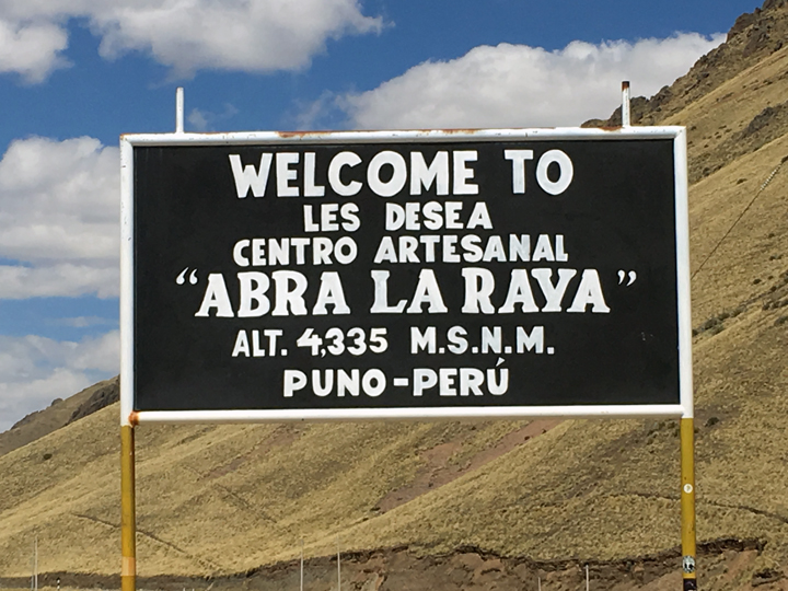 Abra la Raya at 14,222 feet